The Evolution of Navigation: From Paper Maps to Smartphones
Navigation has come a long way from the days when Americans relied on bulky paper maps, atlases, and printed directions to get from point A to point B. For decades, physical maps were a staple in every car glovebox and road trip kit. Travelers would meticulously plan routes in advance, sometimes even calling ahead for directions or relying on word of mouth. With the rise of digital technology in the late 20th century, standalone GPS devices like Garmin and TomTom brought a major leap forward by offering real-time location tracking and step-by-step guidance. However, it was the integration of navigation features into smartphones that truly revolutionized how people in the United States navigate daily life. Today, apps such as Google Maps, Apple Maps, and Waze are deeply embedded in American culture, providing not only directions but also live traffic updates, alternative routes, and points of interest. This historical shift reflects not only technological progress but also rapid cultural adoption. The expectation now is immediate access to accurate navigation at our fingertips—anytime, anywhere. As we explore whether smartphone integration is truly reliable for navigation, understanding this evolution helps highlight both the achievements and potential vulnerabilities of depending so heavily on modern mobile solutions.
2. How Smartphone Integration Enhances Navigation
Smartphone integration has fundamentally transformed the way Americans navigate their daily commutes and cross-country road trips. Today’s smartphone navigation apps leverage a suite of advanced features that go far beyond basic turn-by-turn guidance. Let’s break down the core functionalities that make these tools indispensable for modern navigation.
Key Features of Smartphone Navigation Apps
| Feature | Description | Benefit |
|---|---|---|
| Real-Time Traffic Updates | Apps like Google Maps and Waze analyze live data from millions of users to provide instant traffic alerts, accident reports, and alternate route suggestions. | Minimizes delays by avoiding congestion, enabling more accurate arrival times. |
| Voice-Guided Directions | Turn-by-turn voice instructions allow drivers to keep their eyes on the road while following complex routes. | Enhances safety and reduces driver distraction. |
| Smart Vehicle Integration | Platforms such as Apple CarPlay and Android Auto sync navigation apps with in-car infotainment systems, allowing control via dashboard displays and steering wheel buttons. | Simplifies user interface and creates a seamless driving experience. |
| Wearable Device Compatibility | Navigation prompts can be sent directly to smartwatches or fitness trackers, offering haptic feedback or visual cues for pedestrians and cyclists. | Provides discreet, hands-free guidance for non-drivers. |
The Power of Connected Ecosystems
The real strength of smartphone-based navigation lies in its ability to connect with a broader ecosystem of devices. For instance, a driver can start a route on their phone at home, transition seamlessly to their car’s dashboard display via Bluetooth or USB connection, and receive walking directions on their smartwatch after parking. This level of integration makes the entire journey—whether by car, bike, or foot—more efficient and less stressful.
Continuous Data Improvement
What sets American smartphone navigation apart is its reliance on crowdsourced data. Each user’s real-time input helps improve map accuracy, report hazards, and refine suggested routes. This collective intelligence ensures that navigation apps remain responsive to changing conditions, from rush hour in Los Angeles to sudden weather events in the Midwest.

3. Evaluating Reliability: Connectivity, Accuracy, and Coverage
When considering whether you can truly rely on smartphone integration for navigation, it’s essential to analyze the core factors that affect its reliability. Three critical elements come into play: GPS accuracy, cellular connectivity, and overall coverage.
GPS Accuracy: The Backbone of Navigation
At the heart of every smartphone navigation system lies Global Positioning System (GPS) technology. Modern smartphones typically offer robust GPS capabilities, often accurate within a few meters under ideal conditions. However, accuracy can degrade in urban environments—commonly known as “urban canyons”—where tall buildings obstruct satellite signals. Similarly, dense forests or mountainous regions may cause signal reflection or loss, leading to errors in positioning. While most users experience reliable GPS performance on highways and open roads, those venturing off the beaten path may encounter notable discrepancies.
Cellular Connectivity and Data Limitations
Unlike dedicated GPS devices, many smartphone navigation apps depend on a steady internet connection for real-time data such as traffic updates, rerouting, and map downloads. In urban centers across the U.S., cellular networks are generally strong and responsive. Yet, rural areas and remote stretches of interstate highways often suffer from spotty coverage or dead zones. This lack of connectivity can severely impact your ability to receive timely route adjustments or access updated maps—especially if you haven’t pre-downloaded offline data.
Data Caps and Speed Throttling
Another consideration is your mobile data plan. High-resolution maps and live traffic information can quickly consume significant amounts of data. For users with limited plans or those approaching their monthly cap, this could result in throttled speeds right when precise navigation is most needed. While some apps offer offline modes to mitigate these issues, not all features are accessible without an active connection.
Regional Service Gaps and Infrastructure
The reliability of smartphone navigation isn’t uniform across the United States. Some regions—particularly national parks, rural Midwest communities, or mountainous Western states—may lack sufficient cell towers to support continuous navigation services. Additionally, certain mapping platforms might have less comprehensive data for lesser-known areas, leading to incomplete directions or outdated route information.
Bottom Line: Context Matters
In summary, while smartphone integration offers remarkable convenience and functionality for navigation in most scenarios, its reliability hinges on a combination of GPS accuracy, network availability, and up-to-date mapping resources. Understanding these limitations is crucial before relying solely on your phone for critical journeys—especially when traveling through less connected or unfamiliar territories.
4. Common Pitfalls and User Experiences
Despite the convenience and widespread adoption of smartphone integration for navigation, American users consistently report a range of common pitfalls that can impact reliability and safety. These real-world experiences highlight areas where technology still falls short, especially in the context of everyday driving across diverse environments in the United States.
Signal Loss and Connectivity Challenges
One of the most frequently encountered issues is signal loss, particularly in rural or mountainous regions where cellular coverage is sparse. Many drivers recount situations where their navigation apps lost GPS signal mid-route, leaving them to rely on memory or physical maps. This challenge is especially pronounced during long road trips through states like Montana or Wyoming, where infrastructure gaps remain significant.
App Glitches and Software Reliability
Navigation apps are not immune to glitches or crashes, which can occur unexpectedly. Users have reported sudden app freezes, delayed route recalculations, and even incorrect turn-by-turn directions—problems that are both frustrating and potentially dangerous in high-speed or unfamiliar traffic scenarios. A commuter from Los Angeles shared how a popular app redirected her onto a closed freeway exit, causing major delays during rush hour.
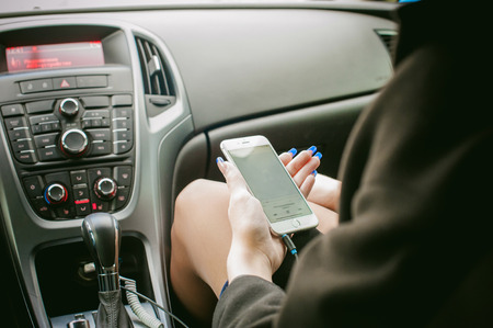
Distraction Concerns
The integration of smartphones with vehicle infotainment systems introduces another layer of risk: distraction. Notifications, incoming calls, or the temptation to interact with the device while driving can compromise focus. The National Highway Traffic Safety Administration (NHTSA) has documented an increase in distraction-related incidents linked to mobile device use behind the wheel.
User Anecdotes: Real-World Insights
| Location | Pitfall Experienced | User Insight |
|---|---|---|
| Northern Arizona | No Signal in Remote Areas | “The map just froze as soon as I left town—I had no clue where the next gas station was.” |
| Chicago Suburbs | App Glitch During Detour | “Waze kept rerouting me in circles after a crash blocked my usual exit.” |
| Florida Highways | Distraction by Notifications | “A text alert popped up while I was merging, which nearly caused me to miss my turn.” |
| Pacific Northwest | Voice Assistant Misinterpretation | “I asked for directions to Portland but ended up getting a route to a Portland Avenue two hours away.” |
These anecdotes underscore that while smartphone-based navigation offers powerful features, its effectiveness is sometimes undermined by technical limitations and human factors. Recognizing these common pitfalls is crucial for making informed decisions about when and how to rely on smartphone integration for navigation on American roads.
5. When to Trust—and When to Double-Check—Your Smartphone Navigation
Smartphone navigation apps have become almost second nature for American drivers and travelers, but knowing when to rely on them—and when a healthy dose of skepticism is needed—can make all the difference between a smooth trip and unexpected headaches. While these apps are engineered with advanced algorithms and real-time data, their effectiveness can still be influenced by several variables such as signal strength, map updates, or even software bugs.
Trust in Familiar Areas and Routine Commutes
For everyday commutes or routes you know well, smartphone navigation serves as a convenient tool for traffic updates, alternate routes, and estimated arrival times. These scenarios generally present low risk if your app makes a minor error; you can usually self-correct based on local knowledge. In these situations, trusting your device is typically reasonable.
Double-Check During Critical Journeys
When embarking on critical journeys—think business meetings in unfamiliar cities, long-distance road trips, or airport runs where timing is crucial—it’s wise to layer in additional caution. Before you hit the road, verify the route using another trusted source, such as Google Maps’ web version or a paper atlas. Download offline maps in case you lose signal, especially in rural or mountainous regions where dead zones are common.
Backup Options: Don’t Rely Solely on One Device
If your journey has little margin for error, consider having a backup navigation solution ready. This could mean bringing along a printed map or pre-loading directions onto a second device. Many Americans keep an old-school GPS unit in the glovebox for emergencies—a habit that pays off when technology hiccups occur at the worst possible moment.
Tips for Navigating Like a Pro
- Always check for app updates before leaving to ensure you have the latest maps and features.
- Use “street view” or satellite imagery to familiarize yourself with key turns or tricky intersections ahead of time.
- If possible, share your live location with friends or family during critical drives for an added layer of safety.
- Pay attention to road signs—sometimes local detours or construction zones won’t be reflected instantly in your app.
The bottom line: trust your smartphone navigation for convenience, but stay alert and prepared with alternative options for those high-stakes journeys. Smart planning lets you enjoy the benefits of technology without falling victim to its occasional pitfalls.
6. What’s Next: The Future of Integrated Navigation Systems
Looking forward, the landscape of navigation technology in the U.S. is poised for dramatic transformation. With smartphones already at the center of our daily journeys, emerging trends promise to further redefine what it means to navigate with confidence and efficiency.
Augmented Reality: Enhancing Real-World Guidance
Augmented reality (AR) is set to revolutionize how Americans interact with navigation apps. Companies are developing AR overlays that project real-time directions onto your smartphone screen or windshield, seamlessly blending digital guidance with physical surroundings. This hands-free, intuitive experience can minimize distractions and make complex intersections or unfamiliar areas easier to navigate, especially in dense urban environments.
Autonomous Vehicles: Redefining the Role of Navigation
The rise of autonomous vehicles will shift navigation from an active task to a more passive user experience. Instead of following turn-by-turn directions, passengers will input destinations and trust advanced systems to make optimal route decisions based on live data and predictive analytics. This evolution not only enhances safety but also opens opportunities for car manufacturers and tech companies to offer personalized travel experiences tailored to individual preferences and habits.
Advanced AI: Smarter, More Predictive Navigation
AI-driven navigation is moving beyond simple routing and traffic updates. Future systems will leverage machine learning to anticipate user needs—suggesting routes based on calendar events, real-time weather patterns, or even local events that might cause congestion. Integration with smart home devices and wearables will allow for seamless transitions between walking, driving, and public transit while keeping navigation context-aware and highly adaptive.
U.S.-Centric Considerations
These technological advancements must address uniquely American challenges, such as vast rural expanses, inconsistent cellular coverage, and diverse transportation infrastructure. As integration deepens, expect providers to prioritize offline capabilities, enhanced privacy controls, and hyper-localized data sources to ensure reliability coast-to-coast.
Conclusion: Navigating Tomorrow’s Roads
The convergence of AR, autonomous vehicles, and advanced AI marks the next frontier in integrated navigation. While today’s smartphone-based systems are powerful, tomorrow’s solutions promise even greater accuracy, convenience, and personalization—transforming not just how we get from point A to B but how we experience every journey across America.