1. Introduction
Autonomous vehicles rely heavily on accurate mapping and navigation systems to operate safely and efficiently. These systems allow self-driving cars to understand their surroundings, plan routes, and make real-time driving decisions. However, creating and maintaining reliable maps and navigation frameworks presents several challenges that must be addressed to ensure the widespread adoption of autonomous technology.
Why Mapping and Navigation Matter
For an autonomous vehicle to function properly, it must have access to high-precision maps and advanced navigation algorithms. These components help the vehicle:
- Understand road structures, including lanes, intersections, and traffic signals
- Identify obstacles such as pedestrians, cyclists, and other vehicles
- Adapt to changing traffic conditions and unforeseen obstacles
- Optimize routes to improve efficiency and reduce travel time
Key Challenges in Mapping and Navigation
Despite significant advancements, mapping and navigation for autonomous vehicles still face multiple challenges. These challenges include:
| Challenge | Description |
|---|---|
| Real-Time Updates | Roads and environments constantly change due to construction, accidents, and weather conditions, requiring frequent map updates. |
| Sensor Limitations | GPS, LiDAR, and cameras have limitations in adverse weather conditions or low-visibility environments. |
| Complex Urban Environments | Heavy traffic, pedestrian movement, and unpredictable obstacles make navigation more difficult in cities. |
| Data Processing | Autonomous vehicles must process large amounts of data in real-time to make split-second decisions. |
The Future of Mapping and Navigation
To overcome these challenges, researchers and automakers are working on solutions such as AI-driven map updates, advanced sensor fusion, and real-time cloud-based navigation. As technology progresses, mapping and navigation will continue to evolve, making autonomous vehicles safer and more reliable.
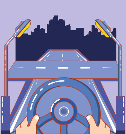
2. High-Definition Mapping Challenges
High-definition (HD) maps are essential for autonomous vehicles to navigate accurately, but maintaining them is a significant challenge. These maps require constant updates to reflect real-world changes such as new road signs, lane closures, or construction work. If maps are outdated, self-driving cars may make incorrect decisions, leading to potential safety risks.
Keeping Maps Up-to-Date
One of the biggest issues with HD mapping is keeping the data current. Roads change frequently due to construction, accidents, or weather-related damage. Unlike traditional mapping services that can tolerate minor inaccuracies, autonomous vehicles require precise and real-time data.
Data Storage Constraints
HD maps contain an immense amount of data, including lane markings, traffic signals, road curvature, and objects around the road. Storing and managing this data efficiently is a challenge. Onboard vehicle storage is limited, and continuously retrieving map updates from the cloud requires stable and fast internet connectivity.
Comparison of Storage Challenges
| Challenge | Impact |
|---|---|
| Limited onboard storage | Vehicles may not have space for constantly updated HD maps. |
| Cloud reliance | Slow or no internet can affect map updates and accuracy. |
| Large data size | Processing high-resolution maps in real-time requires significant computing power. |
Scalability Concerns
Expanding HD mapping coverage across cities and rural areas is another major challenge. While urban areas might have frequent updates, rural regions could be left with outdated maps for longer periods. Additionally, the cost of continuously mapping and updating roads on a global scale is extremely high.
![]()
3. Real-Time Localization and Sensor Limitations
Challenges in Accurate Localization
Autonomous vehicles rely on a combination of sensors and GPS data to determine their precise location. However, achieving reliable localization is challenging due to sensor inaccuracies, environmental factors, and GPS limitations.
Sensor Inaccuracies
Self-driving cars use LiDAR, cameras, radar, and other sensors to map their surroundings. While these sensors provide critical data, they are not always perfect. Factors like sensor calibration errors, noise in the data, and hardware malfunctions can lead to incorrect positioning.
Common Sensor Issues
| Sensor Type | Common Issues |
|---|---|
| LiDAR | Limited range in bad weather, struggles with reflective surfaces |
| Camera | Affected by lighting conditions, can struggle with object recognition |
| Radar | Limited resolution, difficulty distinguishing small objects |
| Ultrasonic | Short range, ineffective at high speeds |
Environmental Challenges
Even with accurate sensors, environmental factors can disrupt localization. Buildings, tunnels, and trees can block signals, while adverse weather conditions like fog, rain, or snow can interfere with sensor readings.
GPS Limitations
GPS is essential for global positioning, but it comes with inherent limitations. In urban environments with tall buildings (a phenomenon known as urban canyoning), GPS signals can reflect off surfaces, causing inaccurate readings. Additionally, GPS signals can be weak or lost in tunnels, parking garages, and heavily wooded areas.
Factors Affecting GPS Accuracy
| Factor | Impact on GPS |
|---|---|
| Urban Canyons | Signal reflection causes incorrect positioning |
| Bad Weather | Cloud cover and storms can weaken GPS signals |
| Tunnels & Indoor Areas | Loss of GPS signal entirely |
| Satellite Positioning | Fewer satellites in view can reduce accuracy |
Combining Multiple Technologies for Better Accuracy
Because GPS and sensors have limitations, autonomous vehicles use sensor fusion techniques to improve localization. This involves combining data from multiple sources—such as LiDAR, inertial measurement units (IMUs), and GPS—to create a more accurate and reliable positioning system.
4. Four, Dynamic and Unstructured Environments
Autonomous vehicles rely on highly detailed maps and sophisticated sensors to navigate safely. However, real-world driving conditions can be unpredictable, making it challenging for these systems to function properly. Construction zones, temporary road changes, and inclement weather can all disrupt mapping and navigation.
Challenges in Navigating Changing Environments
One of the biggest difficulties in autonomous driving is dealing with areas that are constantly changing. Construction projects can alter the road layout, block lanes, or introduce temporary detours. Since mapping systems often rely on previously collected data, these sudden changes may not be reflected in the vehicles navigation system.
Construction Zones
Construction sites can present obstacles such as:
- Lane closures that force vehicles to reroute
- Temporary signs that override existing road markings
- Workers directing traffic in unexpected ways
Temporary Road Changes
Sometimes, roads are altered for short periods due to events, accidents, or necessary repairs. These changes can confuse an autonomous vehicle if they are not updated in real-time. Here’s how temporary road modifications can impact navigation:
| Temporary Change | Impact on Autonomous Vehicles |
|---|---|
| Detours | Pre-programmed routes become unusable |
| Blocked Roads | Navigation system may not recognize impassable areas |
| Traffic Re-routing | Vehicles must adapt to new paths quickly |
Inclement Weather Conditions
Severe weather can also interfere with navigation. Rain, snow, and fog can reduce visibility and affect the accuracy of sensors. Some common weather-related challenges include:
- Snow covering lane markings, making it difficult for sensors to detect boundaries
- Heavy rain obscuring road signs and lane dividers
- Fog reducing visibility, affecting perception systems
Adapting to Unpredictable Environments
To overcome these challenges, autonomous vehicles must rely on a combination of real-time sensor data, advanced algorithms, and improved decision-making systems. Machine learning and AI-driven adaptive mapping can help address dynamic road conditions by updating routes in real-time, ensuring a safer and more reliable autonomous driving experience.
5. Five. Data Processing and Computational Constraints
The Need for Real-Time Data Processing
Autonomous vehicles rely on a continuous stream of data from sensors such as LiDAR, cameras, and radar to make split-second decisions. A delay in processing this data could lead to inaccurate navigation or, worse, accidents. Real-time data processing is essential to ensure that the vehicle responds instantly to its surroundings.
Edge Computing for Faster Decision-Making
To minimize latency, autonomous vehicles use edge computing, which processes data closer to the source rather than sending it to a centralized cloud. This approach allows for immediate decision-making without reliance on an internet connection. The following table outlines the differences between cloud computing and edge computing:
| Computing Type | Processing Location | Latency | Dependence on Internet |
|---|---|---|---|
| Cloud Computing | Remote Data Centers | Higher | High |
| Edge Computing | On-Vehicle Devices | Lower | Low |
Overcoming Hardware Limitations
Processing vast amounts of data in real-time requires significant computational power. However, autonomous vehicles are limited by size, energy consumption, and heat generation constraints. To address this challenge, manufacturers integrate specialized hardware such as Graphics Processing Units (GPUs) and dedicated AI chips to enhance speed and efficiency without compromising performance.
The Role of Hardware Optimization
Optimizing hardware not only improves real-time processing but also reduces power consumption, which is crucial for electric autonomous vehicles. Advancements in semiconductor technology continue to enhance the capabilities of onboard computing units, ensuring safer and more efficient navigation.
Balancing Accuracy and Speed
While fast processing is necessary, high accuracy is equally important. Autonomous vehicles must strike a balance between speed and precision to avoid errors in mapping and navigation. Sophisticated algorithms, predictive modeling, and advanced filtering techniques help refine real-time data while maintaining quick response times.
6. Conclusion and Future Directions
As technology continues to evolve, the challenges in mapping and navigation for autonomous vehicles can be addressed through advancements in artificial intelligence, machine learning, and collaborative mapping efforts. These innovations have the potential to significantly improve the accuracy, efficiency, and adaptability of autonomous vehicle navigation systems.
Advancements in AI and Machine Learning
AI and machine learning are playing increasingly important roles in enhancing the ability of autonomous vehicles to interpret and respond to their surroundings. Some key improvements include:
| Technology | Potential Benefits |
|---|---|
| Deep Learning Algorithms | Improved object detection and recognition for safer navigation. |
| Reinforcement Learning | Adaptive decision-making based on real-time driving conditions. |
| Edge Computing | Faster processing of sensor data without relying on cloud connections. |
Collaborative Mapping Efforts
One of the biggest challenges in autonomous navigation is keeping maps up to date. Collaborative mapping, where multiple vehicles contribute to a shared database, can improve real-time accuracy and expand coverage in complex environments.
Benefits of Collaborative Mapping
- Continuous map updates based on vehicle data.
- Better adaptation to road changes, such as construction zones.
- Enhanced accuracy in areas with poor GPS signals.
Future Possibilities
Looking forward, the combination of AI-driven navigation and collaborative mapping will make autonomous vehicles more reliable in diverse driving conditions. As computing power increases and vehicle-to-vehicle communication becomes more widespread, these technologies will continue to push the boundaries of what autonomous systems can achieve.